
CASE STUDY DETAILS
A Geospatial Intelligence & Property Analytics Platform
Project Type
Web Application (SaaS)
Challenge
Business users cannot self-serve analytics without SQL knowledge.
Domain
Geospatial Analytics
Impact
Faster property and geographic data analysis for analysts
OVERVIEW
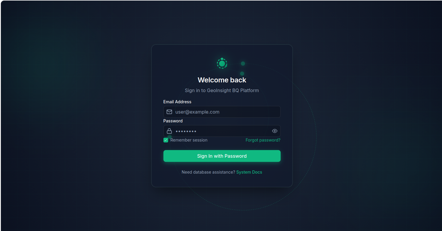
GeoInsight BQ is a comprehensive, enterprise-grade geospatial intelligence platform designed to deliver advanced geographic data exploration, property insights, and location-based analytics through a unified, high-performance web application.
The platform is designed to empower a diverse range of industry stakeholders, including Real Estate Companies, Property Analysts, Insurance Firms, Government Authorities, Property Developers, Market Researchers, and GIS Analysts, providing role-based access to relevant data, tools, and analytical capabilities.
The system is engineered to support real-time geospatial querying, interactive property mapping, BigQuery-powered data analytics, and multi-role operational management, delivering a seamless end-to-end experience for geographic data visualization, property intelligence, and informed decision-making.
PROBLEM STATEMENT
The geospatial analytics and property intelligence industry demands speed, accuracy, geographic precision, and data transparency.
Yet many existing tools struggle with fragmented data sources, limited query capabilities, poor map interactivity, and lack of role-based access control.
- Disconnected property, parcel, and flood risk data across multiple sources
- No unified platform for querying, visualizing, and mapping geographic data
- Limited access to real-time BigQuery-powered geospatial datasets
- Inefficient workflows for property analysts and GIS professionals
- Lack of role-specific dashboards for different user types (Viewers, Analysts, Admins)
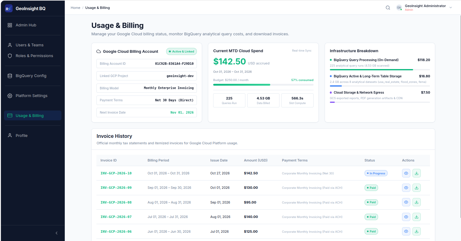
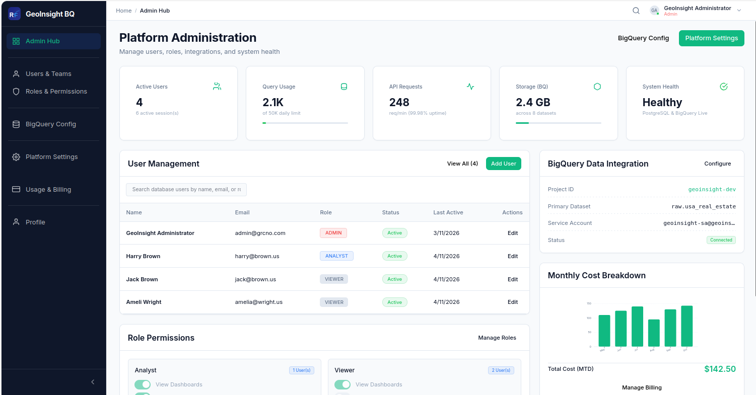
- Poor administrative visibility into user activity, system health, and billing
SOLUTIONS
GeoInsight BQ provides a comprehensive, real-time, and scalable geospatial analytics solution built to handle large spatial datasets, complex SQL queries, and multi-role workflows.
1. Unified Multi-Role Web Platform
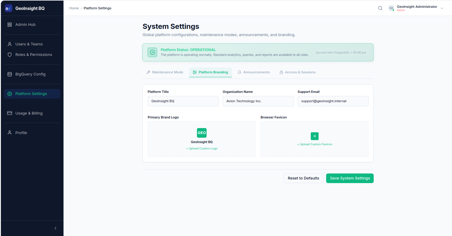
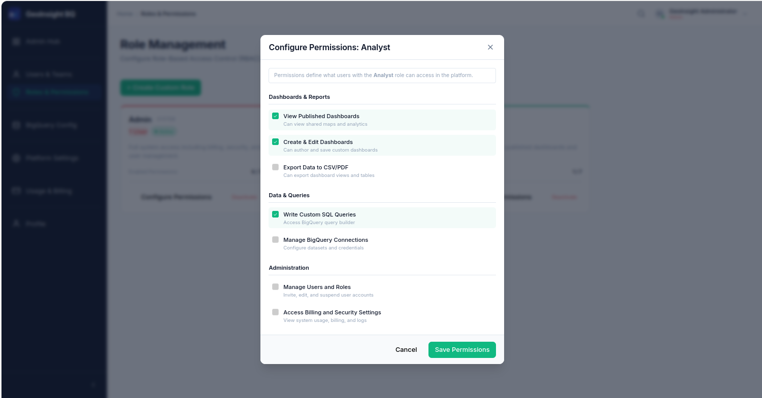
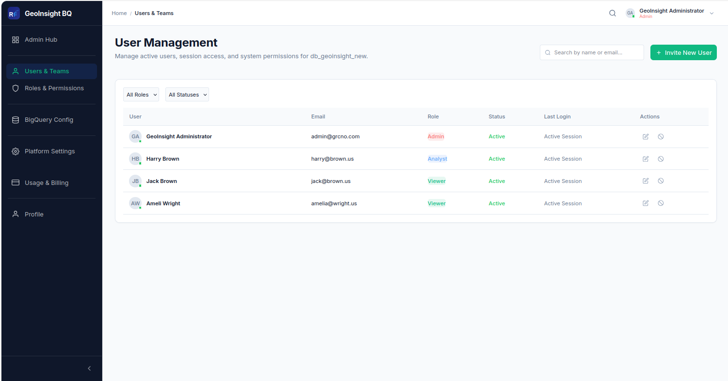
- UDedicated role-based workspaces for Viewers, Analysts, and Admins.
- Role-specific features, workflows, and dashboards tailored to individual stakeholder responsibilities.
- Improved usability, operational clarity, and platform scalability through structured access management.
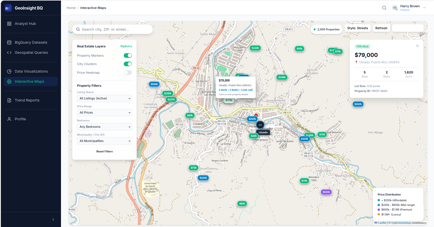
3. Interactive GIS Map Visualization
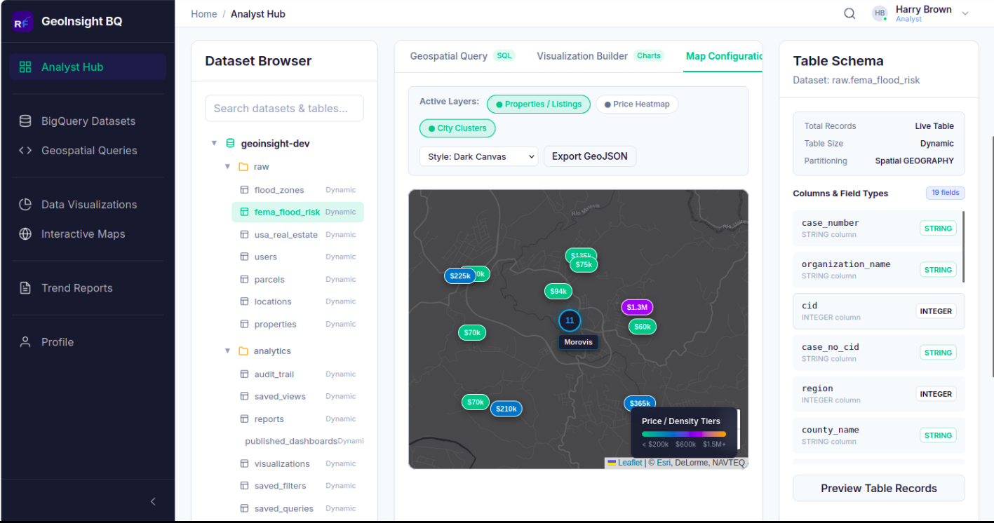
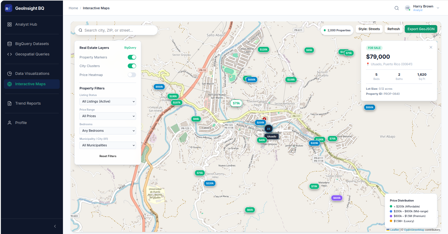
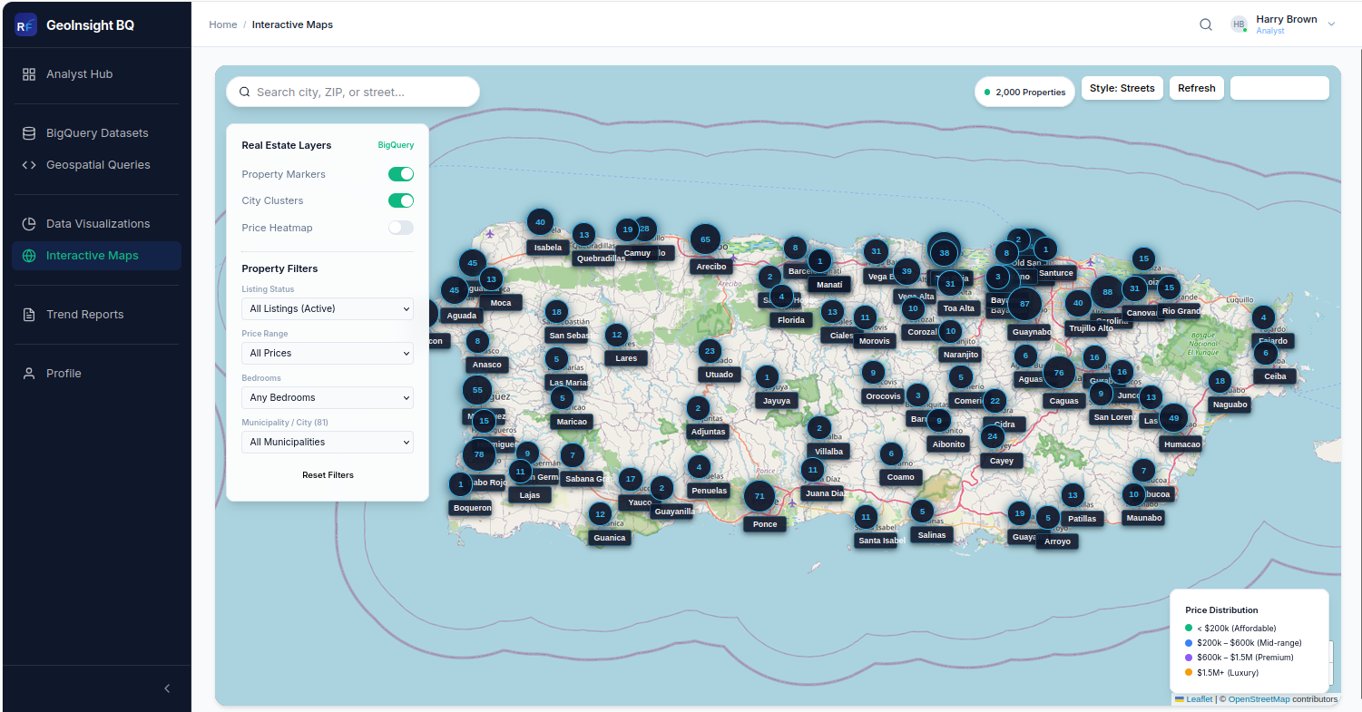
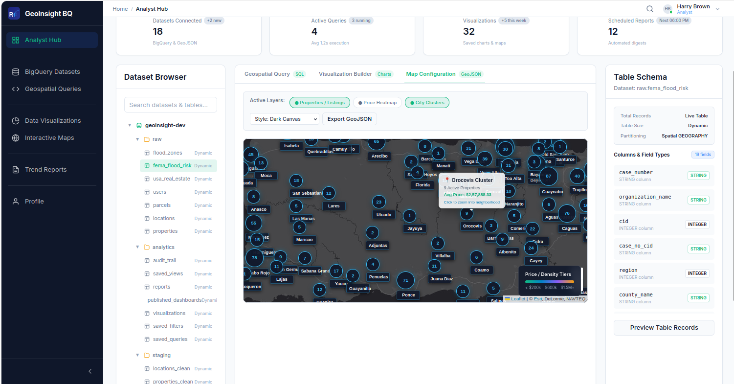
- Leaflet.js integration enables real-time visualization of property and parcel layers on interactive maps.
- Supports advanced geospatial visualization features, including property price heatmaps and city-level clustering.
- Provides multiple map themes (Dark Canvas, Light Vector, and Satellite Terrain) along with GeoJSON export capabilities.
5. Scalable Hybrid Architecture
- FastAPI backend provides a scalable and high-performance API architecture for application services.
- Google BigQuery handles large-scale geospatial datasets, analytical queries, and data processing.
- PostgreSQL manages application state, including user accounts, system settings, and audit trails.
2. BigQuery-Powered Geospatial Query Engine
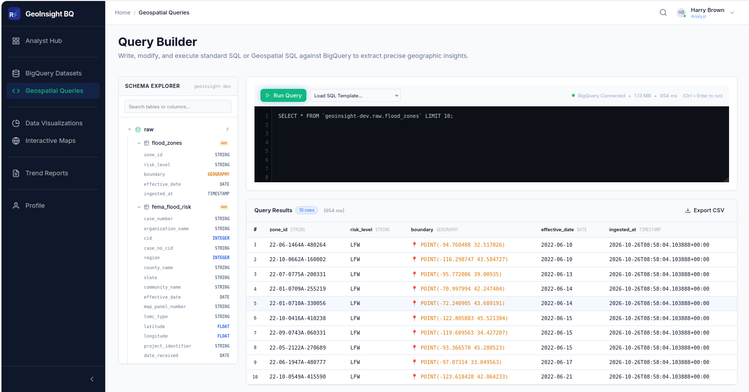
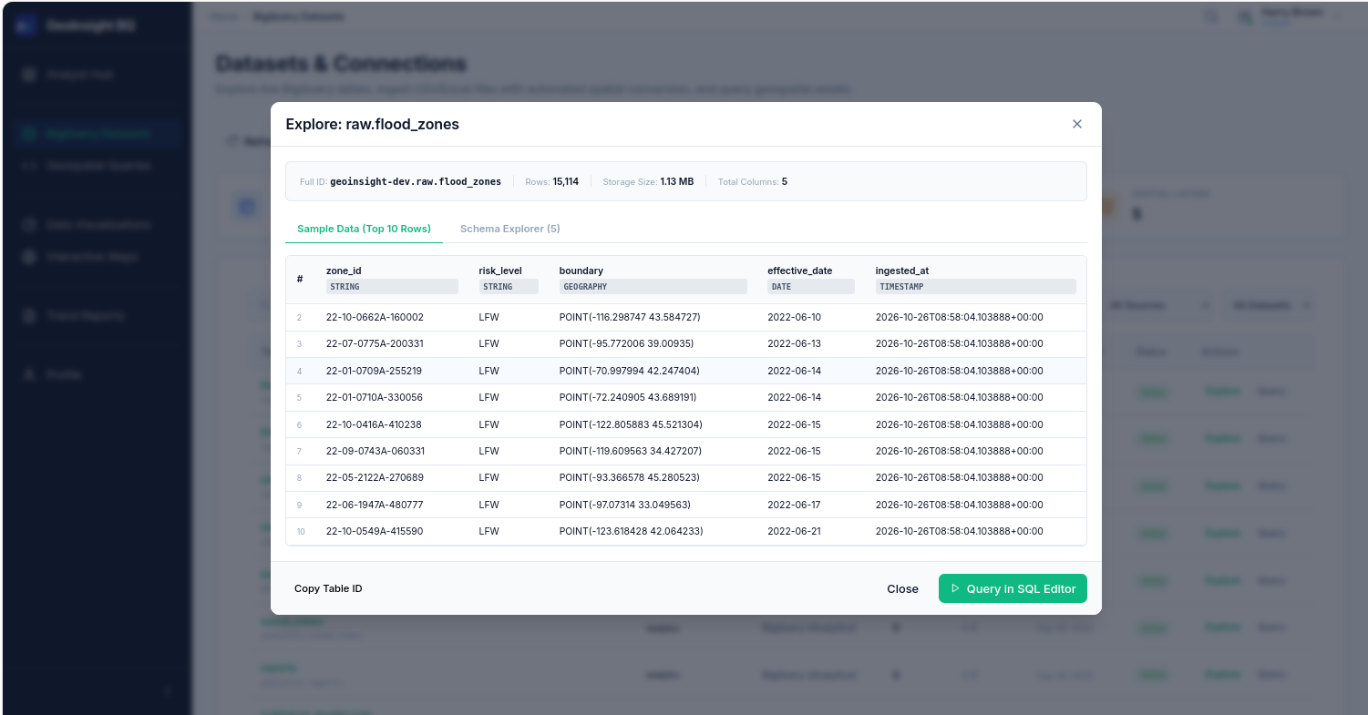
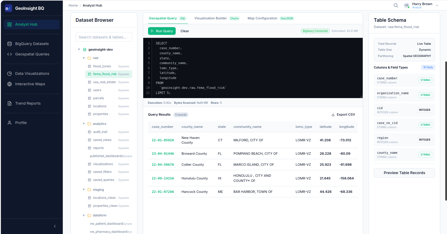
- Direct integration with Google BigQuery enables analysts to execute geospatial SQL queries against live datasets.
- Supports multiple datasets, including FEMA flood risk zones, USA real estate listings, property parcels, and US county boundaries.
- Provides real-time query results with schema inspection, execution statistics, and CSV export capabilities.
4. Viewer Analytics & Market Intelligence
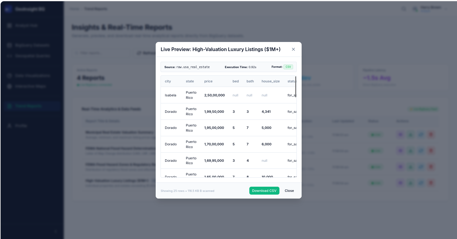
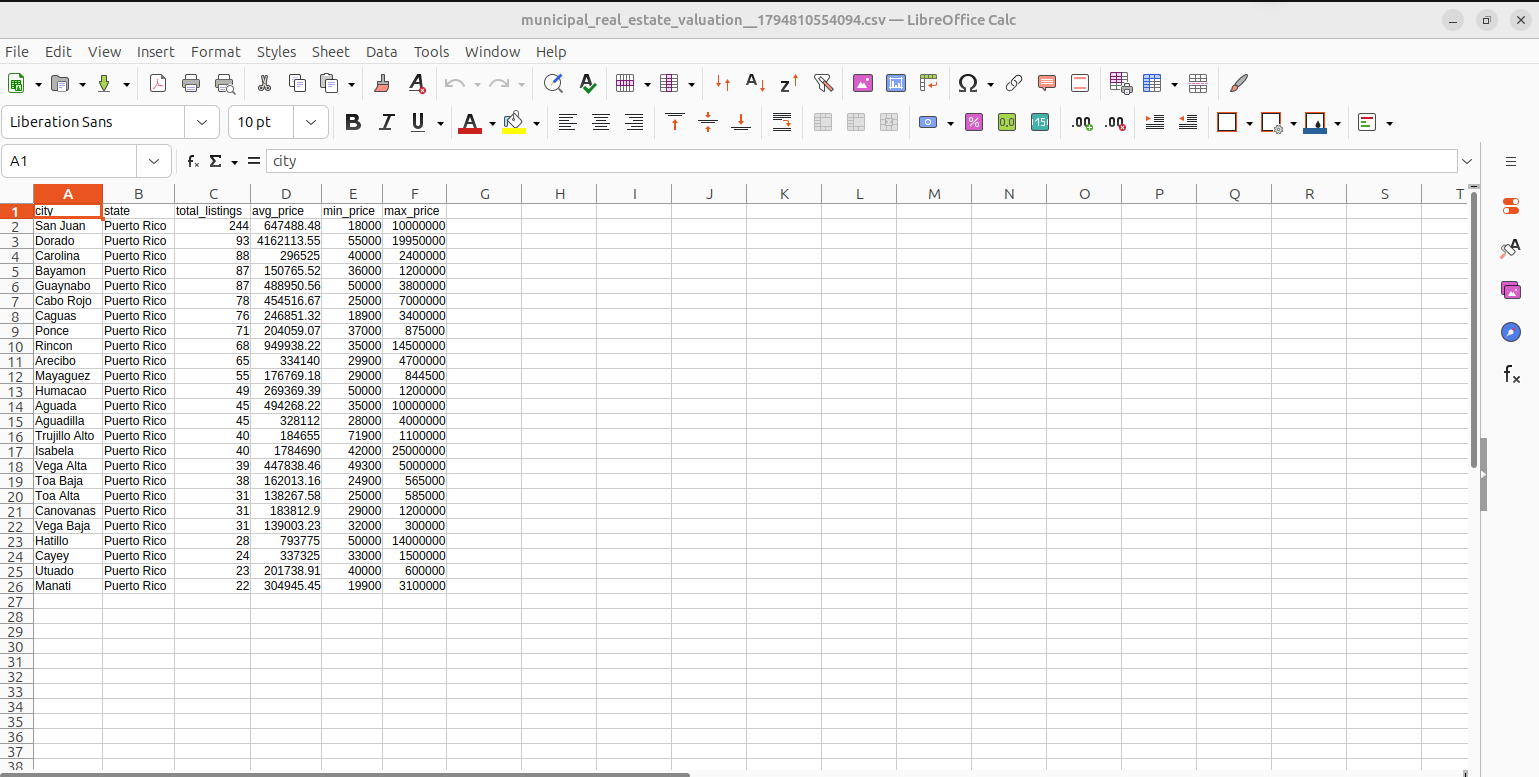
- Provides curated market insights through property KPI cards and interactive geographic visualizations.
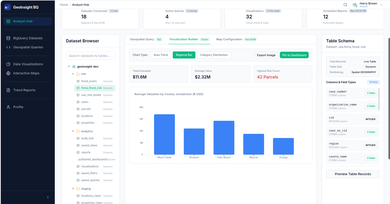
- Displays market trends and price tier distributions through interactive charts and visual analytics.
- Offers top market insights tables with city-level data for better market understanding and informed decision-making.
6. Secure & Reliable Platform Design
- Implements JWT-based authentication to ensure secure user login and session management.
- Enforces role-based authorization to control access to features and resources based on user permissions.
- Uses environment-based credential management and secure API communication between the React frontend and FastAPI backend.
APPROACH
Our Approach
Requirement Analysis & Stakeholder Mapping
- Extensive analysis was conducted to define functional requirements for each user type — Real Estate Companies, Property Analysts, Insurance Companies, Government Authorities, Property Developers, Market Researchers, and GIS Analysts.
- The platform architecture was designed to support high scalability, real-time BigQuery workflows, and seamless user experience.
User Flow Design for Multi-Role Stakeholders
- Designed detailed user journeys for Viewers (market exploration, map interaction, and trend analysis), Analysts (SQL querying, visualization building, and map configuration), and Admins (user management, system configuration, and billing oversight).
- Established intuitive, role-specific workflows to improve usability, streamline operations, and minimize user interaction friction.
BigQuery-Native Data Architecture
- Designed the data layer using Google BigQuery public and custom datasets, covering FEMA flood risk zones, USA property listings, flood zone boundaries, geocoded property records, and US county boundaries.
- Implemented geospatial data support using spatial geometry and BigQuery GEOGRAPHY columns to enable location-based queries, spatial analysis, and interactive map visualization.
Modular Frontend Architecture
- Designed modular React feature modules for each role workspace, supported by a shared component library including Cards, Tables, Charts, Modals, and Badges.
- Established a consistent CSS variables-based design system with reusable GeoMap, BarChart, AreaChart, and PieChart components to ensure UI consistency, maintainability, and scalability.
Real-Time Geospatial Workflow
- FImplemented BigQuery query workflows with live schema tree loading and real-time SQL execution, including bytes processed, rows returned, and query duration statistics.
- Developed dynamic result rendering with type-aware column formatting and GeoJSON-based map data loading, supporting interactive property visualization and clustering.
Agile Development & Continuous Iteration
- Followed an iterative development approach with continuous testing, feedback collection, and incremental improvements.
- Refined UI/UX, application performance, and geospatial workflows to enhance usability, efficiency, and overall system reliability.
SUCCESS AND IMPACT
Platform Validation Results
- UX/UI Design
- Full-Stack Web Application Development
- Geospatial Data Engineering
- BigQuery Data Architecture
- GIS Map Integration
- Google Cloud Platform Integration
Expected Business Impact
- Real Estate Companies & Brokerages
- Property Analytics Firms
- Insurance & Risk Assessment Companies
- Government & Local Authorities
- Property Development Companies
- Market Research Organizations
- GIS & Spatial Data Analytics Teams